OVERVIEW
| Commodity: | Gold |
| Deposit Type: | Orogenic shear-hosted gold |
| Location: | Ontario, Canada |
| Size: | ~5,200 hectares |
| Status: | Available for Option |
The Oakes Project is centered on the Oakes Township just north of Canadian National Highway 11 and about 2km north of the town of Long Lac, Ontario. The Oakes Township is part of the well-endowed Beardmore-Geraldton Greenstone Belt, located northeast of Thunder Bay, Ontario. The Geraldton region has a long and rich mining history and has produced over 4.1 million ounces of gold over the past 100 years including the combined MacLeod-Cockshutt Mine, which produced 1.5 million ounces of gold. More recently, the Hardrock Project held by Greenstone Gold Mines (jointly owned by Equinox Gold and Premier Gold Mines) has elevated attention on the area by announcing their intention to mine their gold resource near Geraldton, Ontario. The Hardrock Project has Proven & Probable Reserves of 5.5Moz at 1.27 g/t Au1.1 1Riverside sees Oakes as an exploration potential eastward extension of this geology and the potential for big new discoveries.
[1] https://www.equinoxgold.com/_resources/projects/technical_reports/2021-Hardrock.pdf
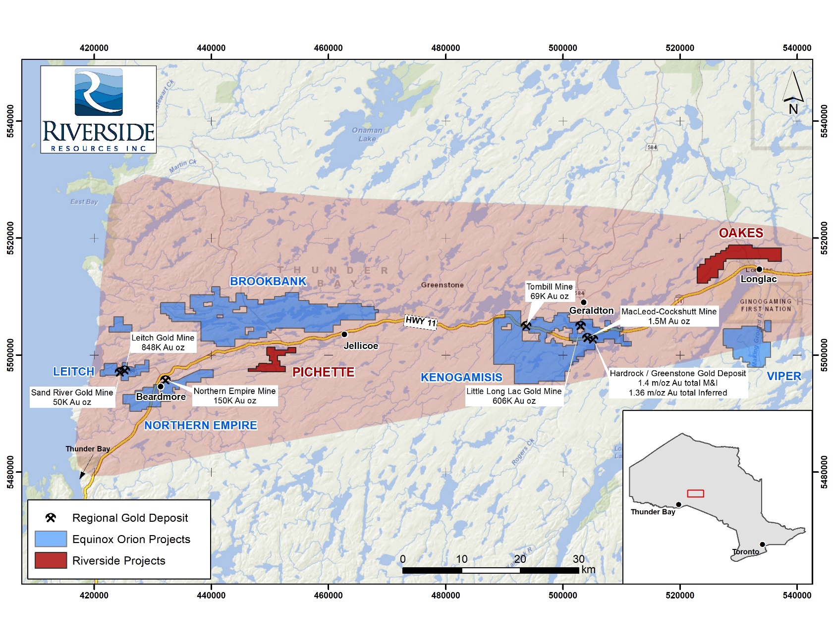
Figure 1: Geraldton Greenstone Belt showing the location of Oakes Project
Pichette and Oakes projects with past producing mines (+4.1M Oz Au in past production)1
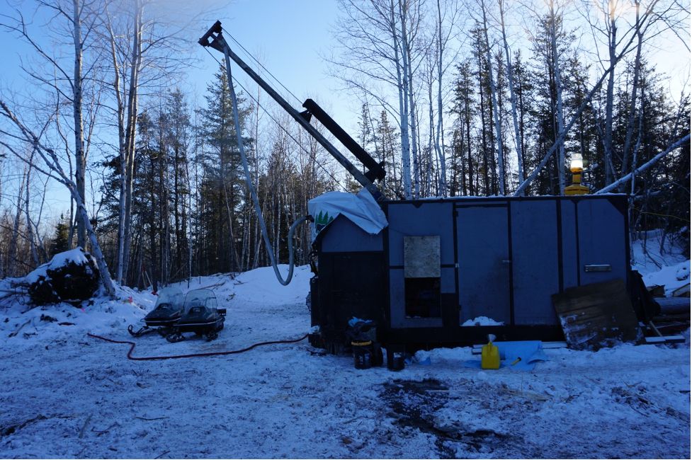
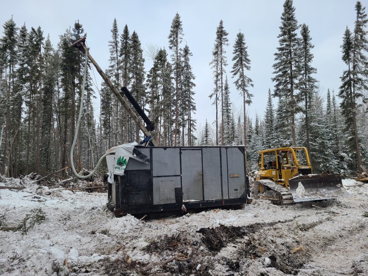
2022 Drill Program
Riverside commenced its self-funded drill program at the Oakes Gold Project in March 2022. The primary focus of the first drill program at Oakes was to test the High Grade (“HG”) target identified by geophysics and trenching programs for gold grades and continuity.
The Induced Polarization (IP) work conducted by Riverside showed the HG IP target extended westward beyond the area of trenching and sampling. Drilling has now confirmed the gold continuity of over 1.2 kilometer along strike, and open in both east and west. The drill results announced in the most recent press release fit with the orogenic gold model and further drilling can be progressed with confidence. As all the holes of this program were shallow with intercepts generally less than 120m the system is considered open at depth.
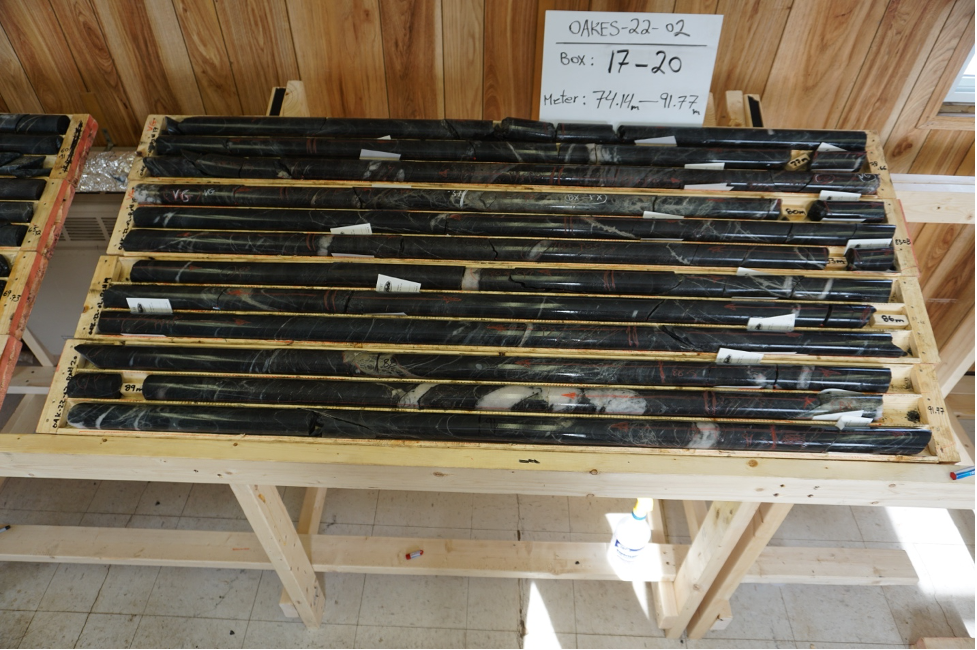
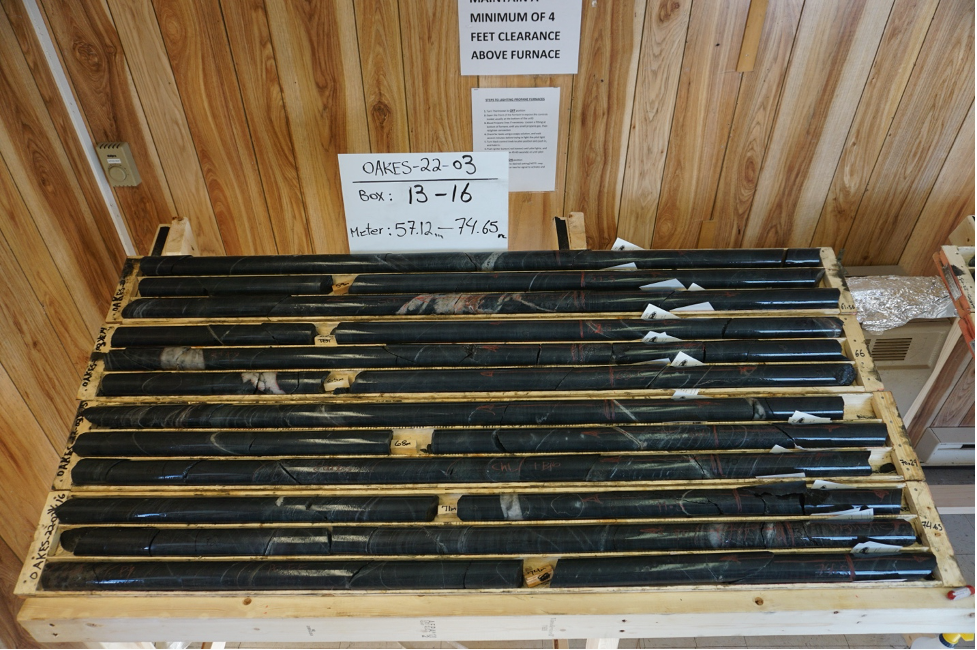
This drill campaign has now successfully expanded the known gold mineralization well beyond the outcrops and laid the groundwork for the next drill campaign to continue expanding the Oakes gold camp. IP data provided strong conductivity and complimentary resistivity anomaly trending roughly east-west parallel to the geological units. The mineralized zone on surface is known to pinch and swell and averages about 4-5 m in width. The best hole in the second batch of reporting was DDH-22-06 which returned 1.7 g/t over 4 m with one sample being almost 5 g/t gold. The best intercept in the program was 8.4 g/t over 1 m in Hole #2.
Table 1: Spring 2022 Drill Program Highlights at Oakes (holes 1-12)
| HOLE# | FROM (m) | TO (m) | INTERVAL (m) | GOLD (g/t) |
| DDH2022-01 | 95 | 96 | 1 | 1.7 |
| DDH2022-02 including |
77 78 |
83 79 |
6 1 |
2.1 8.4 (VG) |
| DDH2022-03 | 73 | 74.5 | 1.5 | 4.0 |
| DDH2022-03 | 84 | 85 | 1 | 1.4 |
| DDH2022-03 | 105 | 106 | 1 | 3.6 |
| DDH2022-03 | 114.5 | 120.5 | 6 | 0.6 |
| DDH2022-04 | 83 | 96 | 13 | 0.2 |
| DDH2022-05 | 94 | 96.5 | 2.5 | 0.8 |
| DDH2022-05 | 102 | 103.5 | 1.5 | 1.5 |
| OAKES-22-06 | 72 | 76 | 4 | 1.7 |
| including | 72 | 73 | 1 | 4.9 |
| OAKES-22-06 | 85 | 88 | 3 | 1 |
| OAKES-22-07 | 98 | 100 | 2 | 0.9 |
| OAKES-22-08 | 9 | 10.5 | 1.5 | 0.4 |
| OAKES-22-09 | 18 | 18.5 | 0.5 | 1 |
| OAKES-22-11 | 22 | 23 | 1 | 2.2 |
| OAKES-22-11 | 96.5 | 98 | 1.5 | 1 |
| OAKES-22-11 | 113.5 | 115 | 1.5 | 1.1 |
| OAKES-22-11 | 125.5.5 | 127 | 1.5 | 2.3 |
| OAKES-22-11 | 151 | 152 | 1 | 0.9 |
| OAKES-22-12 | 106.5 | 108 | 1.5 | 2.4 |
| OAKES-22-12 | 130 | 131 | 1 | 0.4 |
Technical Interpretations & Observations:
Overall, mineralization increases with depth comprising pyrite-pyrrhotite up to 3% total sulfides. Semi-massive pyrite-pyrrhotite was noted in several holes and correlates to increased gold content. Visible gold was found in two holes associated with pyrite and lesser pyrrhotite in areas of quartz veining. The end of the zones is often marked by sections of millimeter-scale porphyroblastic garnets. At Holes -01, -07 and -08 gabbroic units mark the beginning of the mineralized zones. These geologic aspects will form the basis for developing the third dimension and understanding of the HG zone which continues to be progressing.
DDH-22-06 & 07 were designed to intercept the HG Zone beneath Trench 1 at about 100 m depth. The target zone comprises strongly foliated, fine grained, metavolcanic rocks showing strong silicified zones with narrow bleached sections. Alteration comprises abundant biotite and chlorite bands, the top of the unit shows quartz veining with semi-massive pyrite-pyrrhotite and trace chalcopyrite which generally described the mineralized environment at Oakes. Quartz carbonate veinlets and stringers are more frequent from 80 m to 110 m down the hole consistent with the drill target gold bearing area. The overall 25-30m mineralization halo and main zone which is near vertical, now demonstrates strong consistency and provides the Company confidence of a significant gold system at Oakes. DDH-22-08 hit a fault and could not reach the target. DDH-22-09 was the setback collared to drill the Brinklow IP anomaly south of HG Zone, while DDH-22-10 was collared on the Crib Road with the intent to test the IP anomaly associated with the metasediment/metavolcanic contact boundary mapped at this location. Holes 8, 9 and 10 were not intended to evaluate the HG target and were instead testing parallel features. Holes 6, 7, 11, 12 provide technical data specific to the HG trend and give positive results for further exploration at Oakes which lies 25 km east of the Hard Rock Mine.
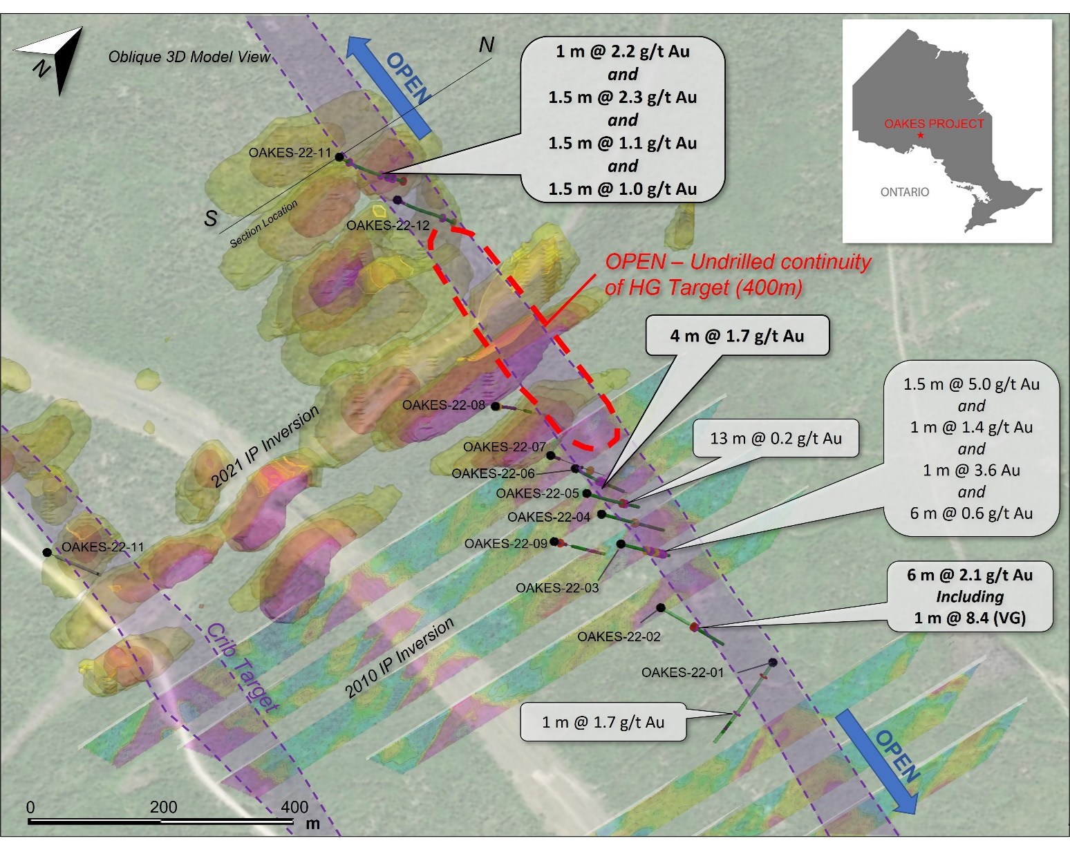 Figure 2: Drill Hole locations for the 12 holes drilled in 2022 plotted on IP Chargeability Map
To view an enhanced version of this graphic, please visit: https://rivres.com/images/projects/canada/oakes_gold_project/DrillHole-locationfor-the12holes-drilled-in-2022_bigger.jpg
DDH-22-11 was targeting an IP conductivity anomaly associated with the HG Zone on trend with the mineralization defined on surface (and in drill core) at Hole 6 located 600 m to the east along what is believed to be the same structure. Assays returned gold results associated with veining throughout the hole and as high as 2.3 g/t gold. Hole 11 was collared in metasedimentary rocks and drilled northward into metavolcanic rocks. Bedding and the contact between the two units was measured at 50 degrees to the core axis whereas foliation and shearing is at about 45 degrees. Alteration comprises moderately to strong biotitic and weak to strong chlorite zones sometimes associated with carbonate zones. Quartz veining and silica content increases starting at 80 m downhole. Sulphides are associated with quartz veins and comprise 2-5% disseminated Pyrite-Pyrrhotite seen within local fracture fillings and stringers.
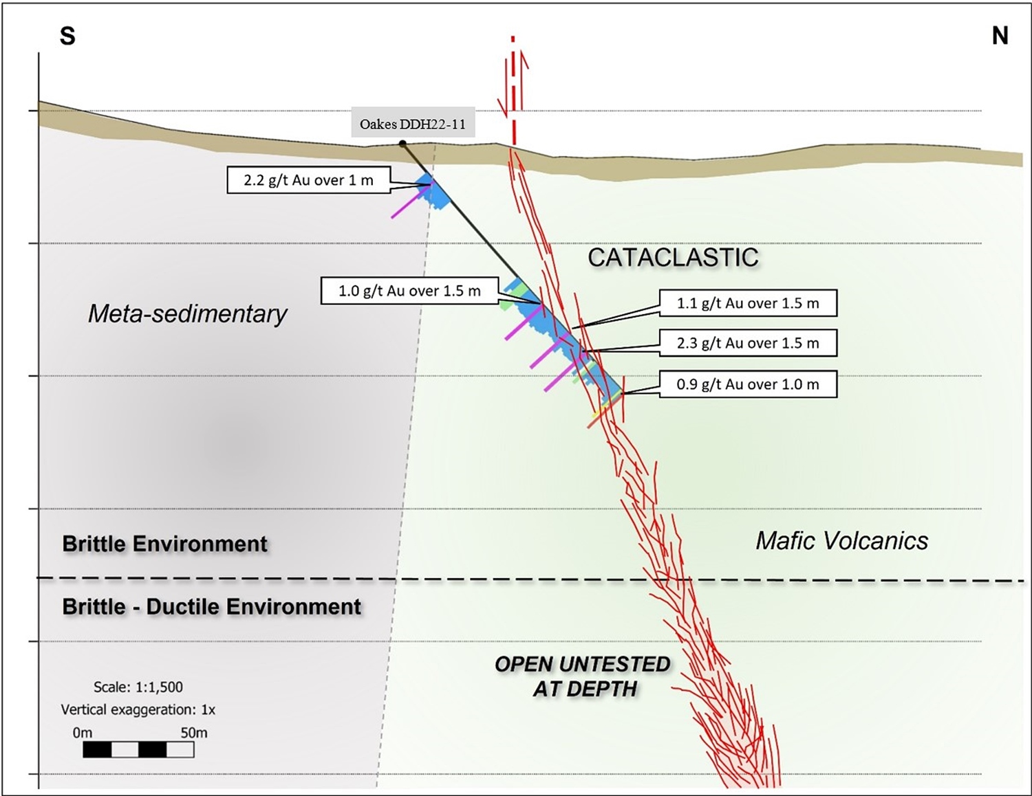 Figure 3: Interpreted North - South Cross Section DDH-22-11 demonstrating the progression from brittle down into brittle-ductile deformation as the targeting model having found gold over 55m drill width zone in hole 11
To view an enhanced version of this graphic, please visit: https://rivres.com/images/projects/canada/oakes_gold_project/InterpretedNorth-SouthCrossSectionDDH-22-11_bigger.jpg
DDH-22-12 was collared in gabbro and drilled north through metasedimentary rock into metavolcanics. Mineralization is noted within similar altered rock but only within shears in the mafic volcanics and does not appear to be associated with the contact zones. Sheared zones commonly a focus for gold mineralization in orogenic systems like this one are expressed as altered, fine-grained, metavolcanics with moderate to strong chlorite-biotite alteration with quartz-carbonate veins and stringers with 1-2% disseminated pyrite and pyrrhotite.
Conclusions:
The HG Zone at Oakes has been proven to extend well beyond the strike extent defined by 2010 trenching and has now been drill proven to at least 1.1 km in length. To date the drilling has only tested the upper 100 m of the structure where gold mineralization is associated with quartz veins that are subparallel to foliation appear to be the veins that carry gold and are cut by later quartz carbonate veins that do not have sulfides. The quartz veins are mostly associated with brittle type fracturing with lesser semi-ductile type, potentially indicating that drilling was approaching the upper brittle-ductile transition which can be highly favorable in large orogenic gold deposits. The nature of the fracturing suggests that the shallow drilling is primarily within the upper brittle deformation zone as shown in Figure 2.
The Oakes property is located along the general metallogenic boundary of the Wabigoon and Quetico sub-provinces and this boundary is commonly a major fault breaks, and large gold resources are associated with these breaks generally in secondary shear zones in the Canadian shield geologic provinces. The Hemlo Gold Mine to the south is hosted in a brittle fracture environment and the Black Fox gold mine to the east in Matheson is hosted in a semi-ductile fracture system at depth and more brittle near the surface. Riverside sees the potential for brittle fracture zones progress into semi ductile and ductile zones at depth in general becoming wider and potentially richer as has commonly been found in the Wabigoon and Abitibi greenstone belts. These conclusions indicate more deeper drilling is warranted.
Project History
Past work on the Oakes project includes two historic drill campaigns, more recent VLF, Mag and IP geophysics in addition to a soil chemistry survey and trenching campaigns. Historical drilling by Hard Rock Gold Mines includes 7 short, BQ-sized holes drilled between 1949-51. Five of the drill holes from the 1950s intersected gold grades above 3 g/t . Only a few rare pieces of core from these past programs are available such that the old work will need to be confirmed and incorporated into new work being conducted by Riverside to produce bonified exploration targets. Drill logs report the mineralized zones that were sampled historically comprised quartz-carbonate veins within sheared mafic volcanics with sulphide mineralization (pyrite, chalcopyrite and galena). This drilling campaign was conducted to trace known veins discovered at surface at depth.
In 1993 in a different area two holes were drilled by Greater Lenora Resources Corp. to test two coincident VLF and copper-in-soil geochem anomalies. Drill logs from the historical reports show the mineralized zones that were sampled comprised meta-basalts (greenschist to amphibolite facies) and tuffs showing silicification and sulphide mineralization (pyrite, chalcopyrite and pyrrhotite). Hole GL-93-1 was drilled to a depth of 153 m and returned anomalous results in gold and copper. Hole GL-93-2 (155 m) intersected an 8.3 m length of semi-massive pyrrhotite mineralization starting at 112m down hole with one, 1.5 m long sample returning 3.3 g/t gold.
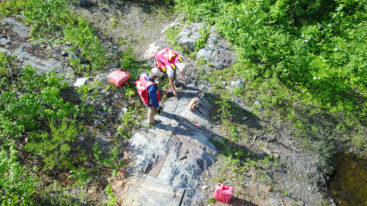
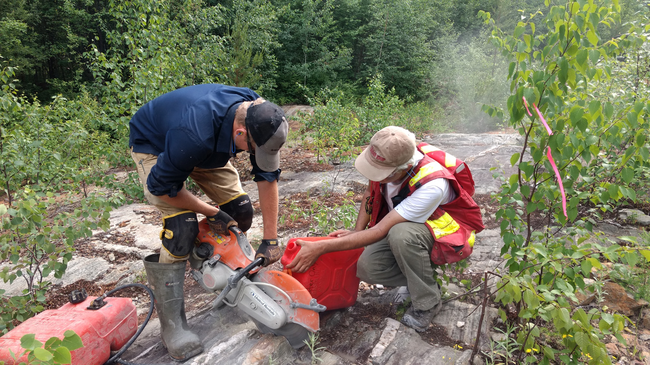
More recent work by Golden Chalice Resources (2010-12) included an IP survey and a trenching campaign. The trenching campaign identified several mineralized shears coincident with VLF and IP chargeability geophysical anomalies. The best trench of six, Trench #1, returned three channel samples of 4.77, 4.17 and 3.41 g/t gold within shear-hosted quartz-carbonate veins. In addition, 26% of the 20 samples taken at Trench #1 returned greater than 1 g/t gold. The best composite sample results from this older work in Trench #1 were 1.3 g/t over 4 m and 1.32 g/t over 4 m. None of the trench work has been followed-up on and most of the complimentary geochemical anomalies have not been drilled. Riverside sees ample opportunity at Oakes to further consolidate the past work and build on the survey work that has showed positive results for gold so far. Riverside in July of 2019 sampled selective sections of the shear zones showing sulphide mineralization that retuned good gold values of 19.7, 31.9 g/t and 6.9 g/t (see press release dated July 29, 2019).
Riverside’s fieldwork indicates gold mineralization at Oakes is hosted within shear zones along contacts between mafic volcanics and gabbroic sills or felsic volcanics
Riverside exploration work
In November 2019, Riverside completed a second round of exploration. The second phase of recently completed work was conducted to identify the east and west extension of this HG shear zone. Riverside geologists mapped and sampled the eastward extension on this shear and found more high-grade gold including 7 g/t gold from the HG shear zone. The new surface samples are believed to demonstrate a mineralized strike length for the HG zone of about 600 m. These samples align with older VLF (1999) and IP anomalies from a survey completed in 2010. The older geophysics shows the anomaly extends both east and west along strike suggesting a potential mineralized strike length of 2.6 km from this data.
Preliminary prospecting and mapping work has traced the known quartz-carbonate vein beyond the high-grade sample location over a strike length of 400 m, and historical surveys and field observations indicate that this vein may extend over a strike length of up to 2 km.
The recent work confirmed three previously identified areas and three other possible target zones.
There are two predominant target orientations:
The first orientation trends east-west and is associated with contact zones that have been delineated by VLF and IP chargeability geophysical surveys
A second orientation target zones trend at 340 degrees (NW) and is defined by linear magnetic lows, field geology and soil geochemistry.
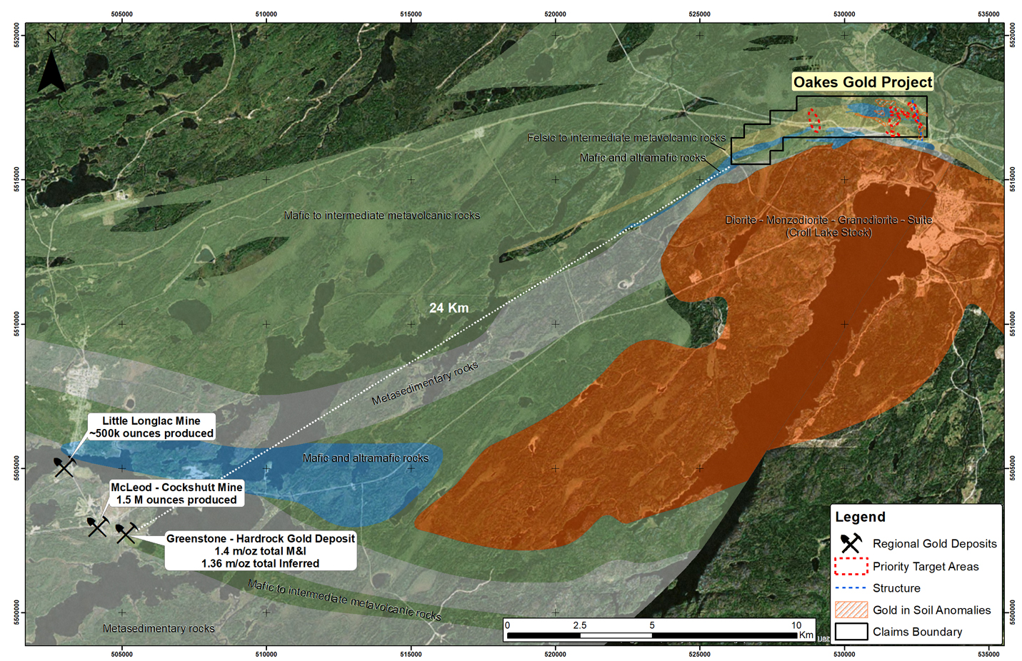
Figure 7: Oakes project with regional geology and distance from large gold deposits
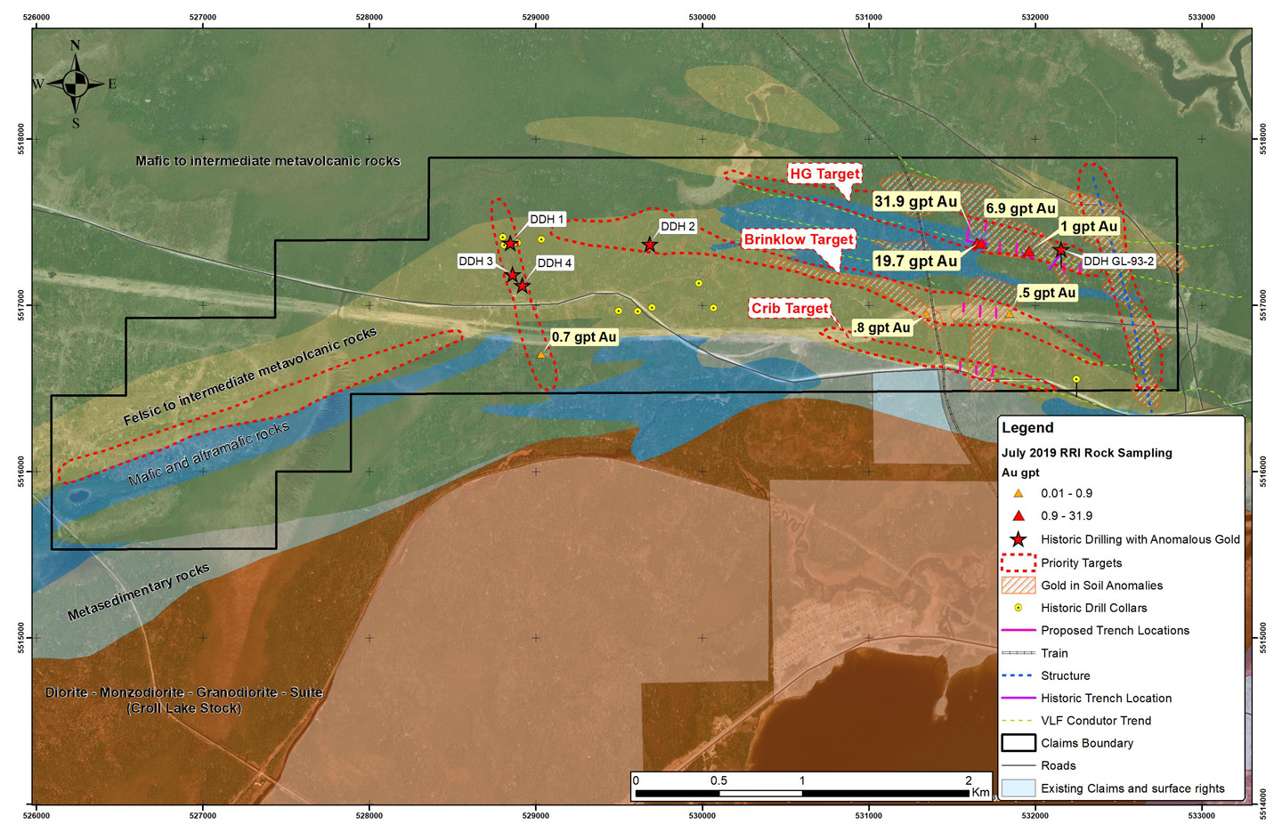
Figure 8: Oakes Project showing geology, gold-in-soil geochemical anomalies, historical drill hole locations and Riversides proposed target locations
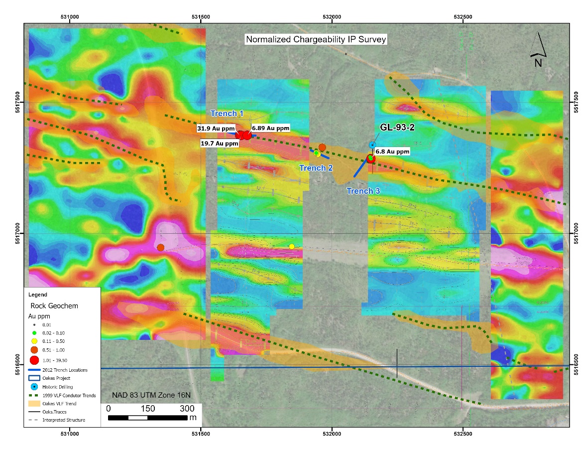
Figure 9: Oakes Project compilation showing HG target with VLF anomalies trend, 2010 IP survey results and recent Riverside sampling delineating high priority drill target extent
Geology
The Beardmore-Geraldton Greenstone Belt (BGGB) has produced about 4.1 million ounces of gold and retains gold resources of several million ounces. The BGGB in the area of the Project is located along the boundary between the Wabigoon and Quetico sub-provinces in the Superior province of the Canadian Shield. These boundaries are often major fault breaks, which can host large gold resources as is found further to the east in the Abitibi Greenstone Belt. Targeting on the Oakes Project and in the belt has focused on the steeply dipping, brittle-ductile shear zones which can comprise various lithologies, metamorphic grades, and alteration styles. The shear zones at Oakes typically strike east-west along the boundary or parallel to the BGGB similar to other past producers and identified gold resources in the area.
The host rock in the project area comprises Archean-aged, meta-volcanics known as the northern volcanic panel part of the larger BGGB and is located where the panel appears to wrap northward around the Croll Lake Stock similar to structural styles of Abitibi gold camps in Eastern Ontario. Specifically, the bedrock comprises a suite of felsic, intermediate and mafic volcanics with gabbroic sills. Volcanic rock types include rhyolitic and andesitic flows, tuffs and breccias, chert, iron formation, minor metasedimentary and intrusive rocks. The more mafic units include basaltic and andesitic flows, tuffs and pillow basalts. The Croll Lake Stock comprises diorite through to granodiorite and syenite. The youngest bedrock includes the northwest trending diabase dikes which are noted throughout the property and region. The metamorphosed mineralized zones are marked by silicification and sulphide mineralization including pyrite, pyrrhotite, galena and arsenopyrite found along contact zones or cross-cutting structures. These mineralized contact zones have been defined by past VLF/Mag surveys complimented and further refined more recently (2008) by follow-up IP surveys and confirmed by trenching in 2010.
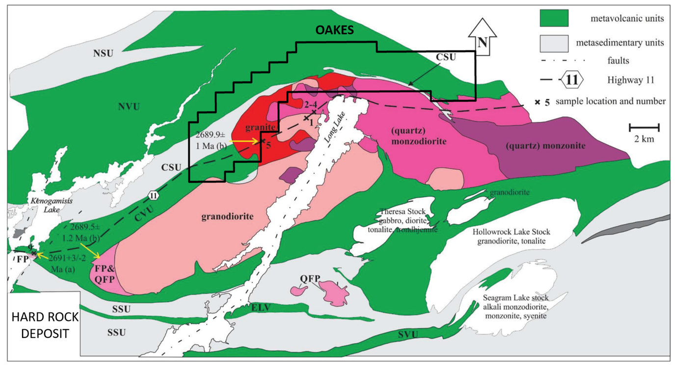
Figure 10: Geology at the Oakes District
Qualified person, QA/QC & technical disclosures
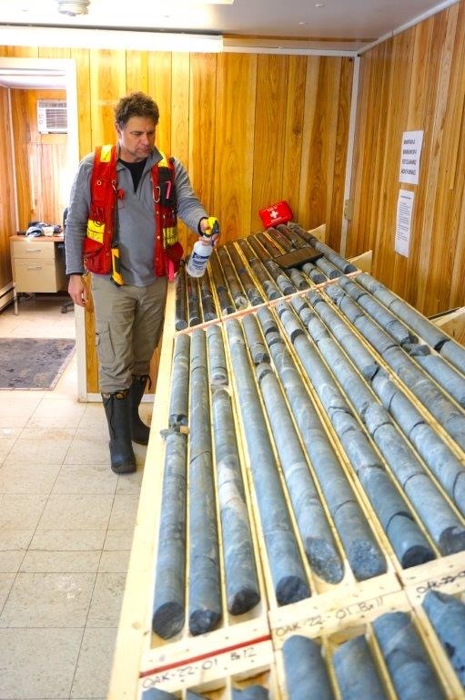
As part of the quality control Riverside inserted blanks, duplicates and two different standards, into the sample stream prior to delivery at Activation Laboratories in Thunder Bay. Logged core was delivered from site to a core cutting facility in Thunder Bay by Riverside and trucked to Activation Laboratories from this facility typically in batches of 2 to 4 holes at a time. Multi-Element Analysis using Aqua Regia Extraction and (40 element) Inductively Coupled Plasma Atomic Emission Spectrometry Analytical and fire assay for gold methods where used. The Company also ran 4-acid total digestion in conjunction with aqua regia over several mineralized zones as a check for the best analysis method. Activation Laboratories is an ISO/IEC accredited laboratory.
The scientific and technical data contained in this news release was reviewed and approved by Freeman Smith, P.Geo., a non-independent qualified person to Riverside Resources, who is responsible for ensuring that the geologic information provided within this news release is accurate and who acts as a “qualified person” under National Instrument 43-101 Standards of Disclosure for Mineral Projects.