
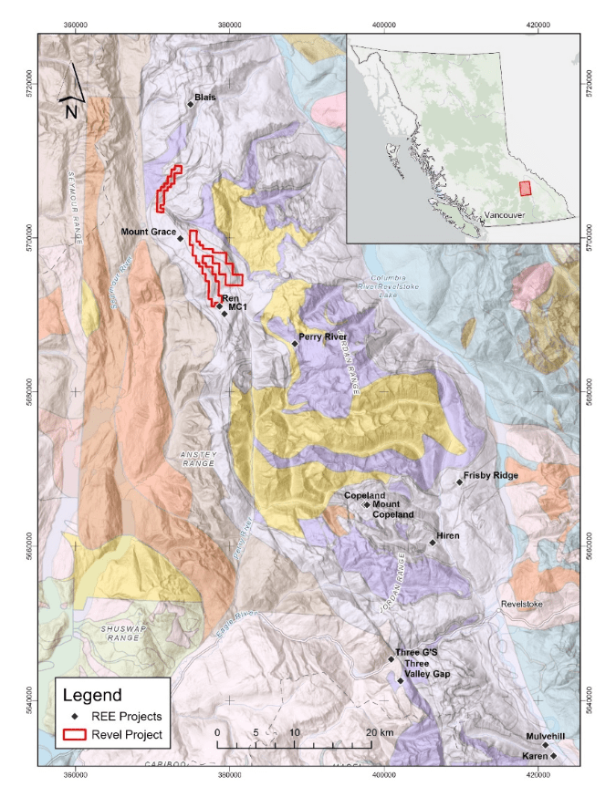
 Figure 1. Regional location map of the Mount Grace Carbonatite and other REE locations superimposed on
geologic quadrangle map from Hoy and Kwong (1986).
Figure 1. Regional location map of the Mount Grace Carbonatite and other REE locations superimposed on
geologic quadrangle map from Hoy and Kwong (1986).
REVEL PROJECT
Commodity: Rare Earth Elements
LOCATION: British Columbia,
Canada SIZE: 2538 ha. (25 Km2)
The Revel Project is located 20 km from the community of Seymour Arm within a highly prospective carbonatite belt north of Revelstoke, BC. The Project is 100% owned by Riverside with no underlying royalties or encumbrances. Access for mineral exploration is conducted from logging roads tied into secondary road access and generally accessible making the exploration cost effective as Riverside builds upon earlier exploration work and REE results.
The claims are partly located on Mount Grace on the northeast margin of Frenchman Cap Gneiss Dome comprising part of the Shuswap Metamorphic Terrain. These core gneisses are overlain by allochthonous cover rocks which host both extrusive and intrusive carbonatites and are part of the Monashee cover sequence. The property is centered on the Mount Grace syncline which is a northwest trending isoclinal fold. The regional map shows the Revel claim areas in the regional context with other known REE locations as part of a north-south trending belt where the Company has been working.